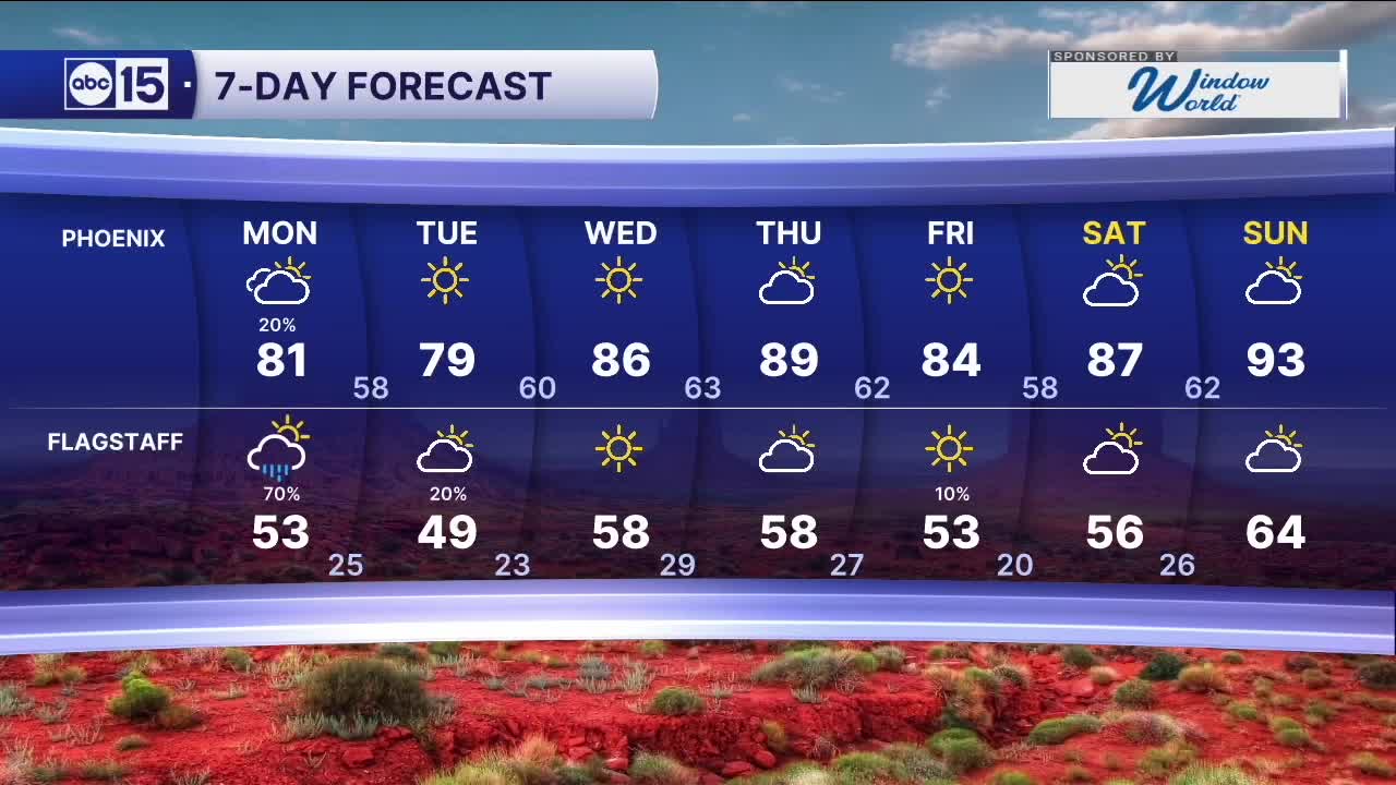


PHOENIX — A storm system is moving in from the west and is set to increase rain chances and even bring some light accumulating snow in the high country on Monday.
Here in the Valley, we may see a few sprinkles and light showers through the day, but the best chance will happen around and after the evening commute. Higher terrain north and northeast of the Valley will have the best chance of picking up around a tenth of an inch.
The storm will push into the high country in the afternoon and evening. As snow levels drop to around 6000-6500 feet into the night, some light snow accumulation is possible. Flagstaff could see between a trace and isolated areas of 2 inches by Tuesday morning.
Winds will also remain breezy with gusts in the Valley over 20 mph and over 30 mph in the high country.
As the storm exits, temperatures will drop. Valley highs by Tuesday will struggle to reach 80 degrees. Temperatures will rebound by midweek before another system passes north of Arizona, helping keep readings closer to seasonal levels by the end of the week.
__________________________________________
Share your weather photos and videos with us anytime: share@abc15.com.
______________________________________
