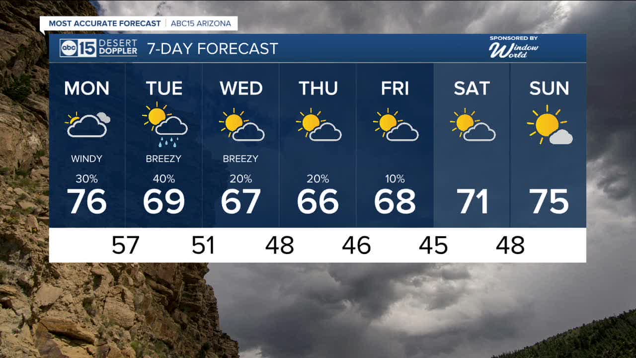


PHOENIX — Big changes in the forecast begin tomorrow on President's Day and keep our weather unsettled all week.
Another storm system will move in from the west. This first one could bring more measurable rain to the Valley and snow to areas above 5,000 feet in elevation.
Rain chances are now in the forecast on Monday, Tuesday, and Wednesday as temperatures gradually drop into the upper 60s in the Valley.
Rainfall potential of up to a quarter of an inch in the Valley, with up to a half an inch of rain over the higher terrain north and east of us.
When it comes to snowfall above 5,500 feet three to six inches with up to eight inches above 8,000 feet.
A Winter Weather Advisory has been issued above 6,500 feet for Monday and Tuesday for the Kaibab Plateau, Flagstaff, Rim Country and the White Mountains.
Additionally, it will be windy at times this week across parts of Arizona, even in the Valley expect gusts of 30 mph.
A Wind Advisory has been issued for Monday and last through Tuesday night across much of Northern, Eastern and Southeastern Arizona. Wind gusts up to 50 mph can be expected.
And all of that is just round one! More rain and snow comes our way Wednesday!
Additional snowfall above 5,000 feet of of four to eight inches.
We are keeping our eye on another system expected to move through Friday.
We'll keep you posted as it gets closer.


2026 Sky Harbor Official Rainfall to date: 0.18" (-1.06" from average)
_________________________________________
2025 Sky Harbor Official Rainfall: 8.31" (+1.09" from average)
Monsoon 2025 Sky Harbor Official Rainfall: 2.76" (+0.33" from average)
__________________________________________
Daily rainfall reports from all across the Valley can be found here.
__________________________________________
PHOENIX IS GETTING DRIER - LOWER RAINFALL AVERAGES NOW
Average Monsoon Rainfall in Phoenix (1981-2010): 2.71" of rain
NEW Average Monsoon Rainfall in Phoenix (1991-2020): 2.43" of rain
Average Yearly Rainfall in Phoenix (1981-2010): 8:03" of rain
NEW Average Yearly Rainfall in Phoenix (1991-2020): 7.22" of rain
__________________________________________
Share your weather photos and videos with us anytime: share@abc15.com.
______________________________________
