

PHOENIX — It was a windy day across State 48, with gusts over 36 mph in Phoenix and even over 45 mph in parts of western and southern Arizona.
While it will remain breezy into Monday, winds will be weaker compared to Sunday. The strongest gusts will be focused in the foothills and higher elevations.
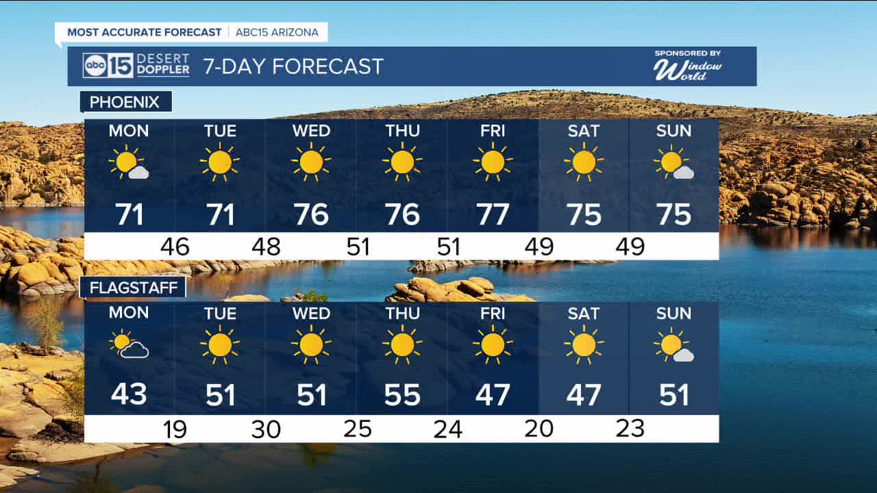
Meanwhile, temperatures will be on a steady rise through the week as a ridge of high pressure intensifies along the West Coast. Despite the warming trend, expect chilly mornings with Valley lows in the 40s through Wednesday morning.
Afternoon highs will hover in the lower 70s to start the week, then climb into the mid to upper 70s by mid to late week. Valley morning lows will also rebound into the 50s for the second half of the week.


2026 Sky Harbor Official Rainfall to date: 0.18" (-0.12" from average)
__________________________________________
2025 Sky Harbor Official Rainfall: 8.31" (+1.09" from average)
Monsoon 2025 Sky Harbor Official Rainfall: 2.76" (+0.33" from average)
__________________________________________
Daily rainfall reports from all across the Valley can be found here.
__________________________________________
PHOENIX IS GETTING DRIER - LOWER RAINFALL AVERAGES NOW
Average Monsoon Rainfall in Phoenix (1981-2010): 2.71" of rain
NEW Average Monsoon Rainfall in Phoenix (1991-2020): 2.43" of rain
Average Yearly Rainfall in Phoenix (1981-2010): 8:03" of rain
NEW Average Yearly Rainfall in Phoenix (1991-2020): 7.22" of rain
__________________________________________
Share your weather photos and videos with us anytime: share@abc15.com.
______________________________________
