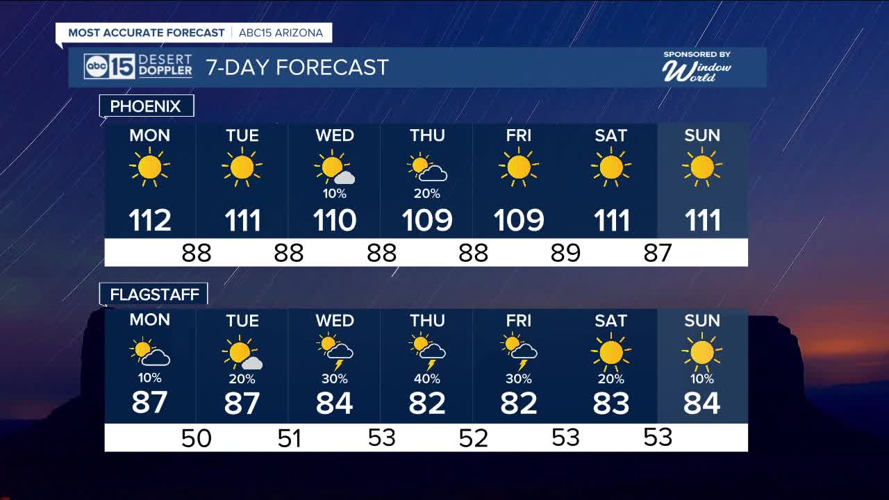
PHOENIX — High pressure is steadily building into the Grand Canyon State and sending temperatures soaring.
Monday will be a major heat risk day as Valley temperatures will exceed 112 degrees in the afternoon.
This major heat risk means anyone is at risk of heat illness. Limit your time outside between 10 a.m. and 6 p.m., and if you have to be outside, make sure to take breaks to cool off and stay hydrated.
Temperatures will remain above normal this week, even with the return of monsoon storm chances.
An Extreme Heat Warning is in place for the Grand Canyon in areas below 4,000 feet. where temperatures could reach 113 degrees.
Monsoon moisture starts to flow back into Arizona this week, increasing rain chance in Eastern Arizona to start the week, then building into the High Country and possibly the Valley for the midweek.
Here in the Valley, the best chance for storms would be Wednesday and Thursday but the position of the area of high pressure will play a crucial role in if the right moisture will be available.
__________________________________________
Daily rainfall reports from all across the Valley can be found here.
__________________________________________
PHOENIX IS GETTING DRIER - LOWER RAINFALL AVERAGES NOW
Average Monsoon Rainfall in Phoenix (1981-2010): 2.71" of rain
NEW Average Monsoon Rainfall in Phoenix (1991-2020): 2.43" of rain
Average Yearly Rainfall in Phoenix (1981-2010): 8:03" of rain
NEW Average Yearly Rainfall in Phoenix (1991-2020): 7.22" of rain
__________________________________________
Share your weather photos and videos with us anytime: share@abc15.com.
______________________________________


