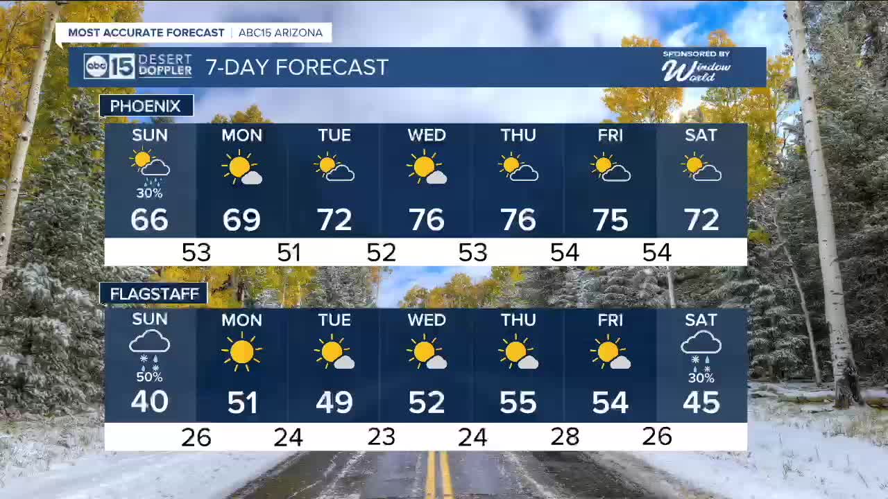


PHOENIX — Our third and final storm system of the week is moving in, bringing steady rain and a few thunderstorms to the state. Rain will continue through much of the overnight and into early Sunday.
The snow level will drop overnight to between 7,000 and 8,000 feet in elevation. This will lead to an inch or two of snow along the Mogollon Rim.
Our highest peaks, above 9,000 feet, could see several inches of snow.
Rain will begin to taper off through the day, especially through the afternoon on Sunday as the storm pulls away from Arizona.
Temperatures will stay cool with daytime highs in the 60s and overnight lows in the 50s.
As high pressure returns next week, we will dry out and warm back up.
Valley highs will return to the 70s starting Tuesday, with temperatures likely in the mid-70s on Thanksgiving.


2025 Sky Harbor Official Rainfall to date: 7.98" (+1.68" from average)
Monsoon 2025 Sky Harbor Official Rainfall: 2.76" (+0.33" from average)
_________________________________________
Daily rainfall reports from all across the Valley can be found here.
__________________________________________
PHOENIX IS GETTING DRIER - LOWER RAINFALL AVERAGES NOW
Average Monsoon Rainfall in Phoenix (1981-2010): 2.71" of rain
NEW Average Monsoon Rainfall in Phoenix (1991-2020): 2.43" of rain
Average Yearly Rainfall in Phoenix (1981-2010): 8:03" of rain
NEW Average Yearly Rainfall in Phoenix (1991-2020): 7.22" of rain
__________________________________________
Share your weather photos and videos with us anytime: share@abc15.com.
______________________________________
