


PHOENIX — Friday will be an ABC15 Weather Action Day as big weather changes impact your day.
A storm system is moving in with wind, rain and a major cool-down.

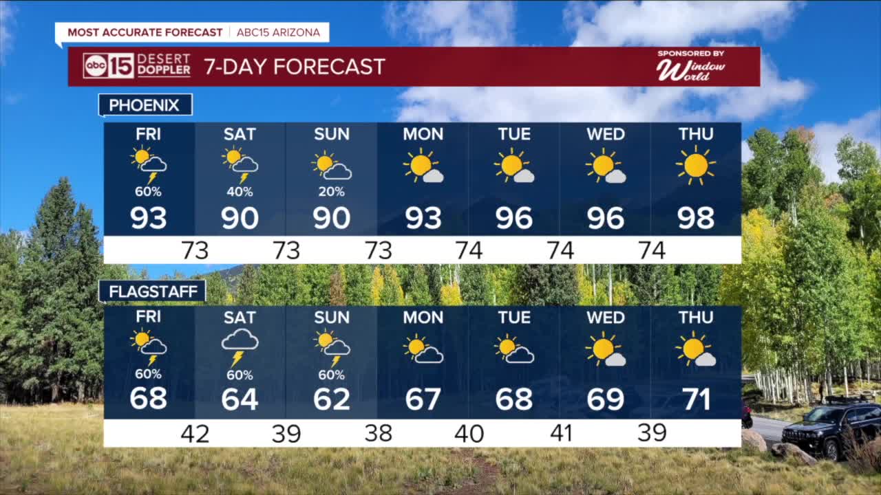
Valley temperatures will drop nearly 15 degrees on Friday, putting highs in the upper 80s to low 90s.
Scattered showers and thunderstorms will develop too, with the best chances in the Valley happening between lunchtime and sunset on Friday.

Strong to severe thunderstorms could bring over a half an inch of rain to parts of the Phoenix metro area, with higher totals in the higher terrain.
That much rain will raise the risk of flooding, so the Valley will be under a Flood Watch on Friday.
Flood Watches on Friday also extend east and southeast of the Valley, including for places like Miami, Hayden, Casa Grande, Tortilla Flat, Cactus Forest, Apache Junction, Sunflower, Coolidge, Punkin Center, San Carlos, Winkelman, Florence, Peridot, Globe, Superior, and Fountain Hills.

Across southeastern Arizona, including in Tucson and Safford, Flood Watches will be in effect through Saturday.
Parts of eastern and southeastern Arizona could get one to two inches of rain.

Flooding may occur in rivers, washes, and other low-lying areas, as well as in city streets and low-water crossings, making travel dangerous. So, turn around if you encounter flooding and do not attempt to drive through it.
There is also a chance of severe thunderstorms, which could bring damaging wind gusts over 60 mph and small hail.

With just a few days left in our monsoon season, this storm system could bring some much-needed rain to our below-normal 2025 season. So far, Phoenix is running more than an inch below normal this monsoon.

Slight chances for spotty storms will continue into Sunday as Valley temperatures remain well below normal for this time of year.
Look for highs in the upper 80s to low 90s Saturday, Sunday and Monday, with overnight lows in the low to mid 70s.

Want more news in your community? Add ABC15 as a preferred source on Google below:
![]()

