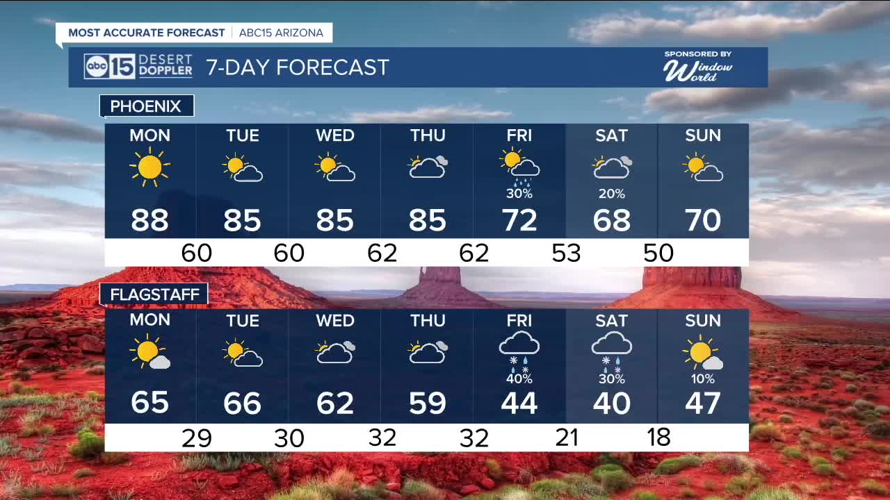


PHOENIX — It was a record warm day in the Valley on Sunday with a high of 90 degrees. This warmth will stick around to start the week before big changes head our way.
High pressure has been in control of the desert southwest. This ridge will weaken into the new week, and clouds will start to increase beginning Tuesday. However, we will still be running warm with highs in the upper 80s on Monday and mid-80s Tuesday through Thursday.
Morning lows will remain in the lower 60s, but get ready for even cooler weather by Friday and the weekend.
A storm system from the Pacific will move in late Thursday, increasing winds, bringing rain chances up, and even a chance for a light snow accumulation across the high country, especially on the higher terrain.
While it is too soon to say, the exact impacts, snow levels are showing 6,500 feet by Saturday morning. This could allow for a light coating of snow. As we get further into the week, we will have a better idea of the extent of the impacts of rain and snow on the state.
One thing that is appearing promising is a big drop in temperatures by next weekend, Valley high may struggle to get out of the 60s, and morning lows may dip into the lower 50s and even upper 40s.
Stay tuned for updates as we get closer!


_________________________________________
2025 Sky Harbor Official Rainfall to date: 7.49" (+1.42" from average)
Monsoon 2025 Sky Harbor Official Rainfall: 2.76" (+0.33" from average)
__________________________________________
Daily rainfall reports from all across the Valley can be found here.
__________________________________________
PHOENIX IS GETTING DRIER - LOWER RAINFALL AVERAGES NOW
Average Monsoon Rainfall in Phoenix (1981-2010): 2.71" of rain
NEW Average Monsoon Rainfall in Phoenix (1991-2020): 2.43" of rain
Average Yearly Rainfall in Phoenix (1981-2010): 8:03" of rain
NEW Average Yearly Rainfall in Phoenix (1991-2020): 7.22" of rain
__________________________________________
Share your weather photos and videos with us anytime: share@abc15.com.
______________________________________
