

PHOENIX — We are tracking the next storm system that could impact New Year’s Eve and New Year’s Day plans statewide.
Due to potential impacts to holiday travel and outdoor plans, Thursday is an ABC15 Weather Action Day. Take action now by planning ahead and allowing extra travel time.
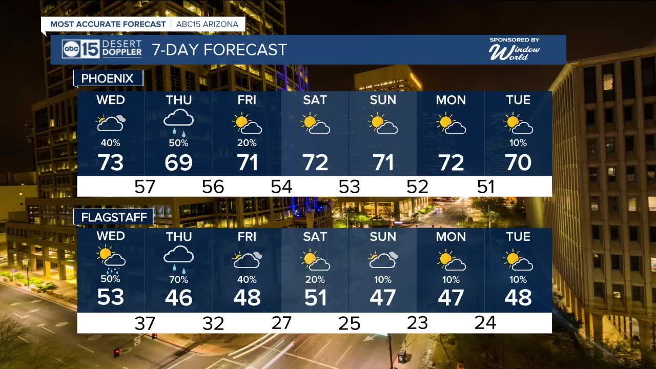
Rain chances increase late Wednesday, with the first round of rain likely after 5 p.m., then becoming more widespread into Thursday morning.
Some areas could see rain linger through New Year’s Day and Friday morning.
Right now, this looks mainly like a rain event statewide.
Snow levels stay high between 9,000 and 10,000 feet, with one to three inches possible in the highest elevations.
Temperatures wise a just slight drop in afternoon highs, New Year's Eve in the low 70s with New Year's Day in the upper 60s.
Dry but cloudy weekend is expected as temperatures even out and in up in the low 70s for both Saturday and Sunday.


2025 Sky Harbor Official Rainfall to date: 8.31" (+1.12" from average)
Monsoon 2025 Sky Harbor Official Rainfall: 2.76" (+0.33" from average)
__________________________________________
Daily rainfall reports from all across the Valley can be found here.
__________________________________________
PHOENIX IS GETTING DRIER - LOWER RAINFALL AVERAGES NOW
Average Monsoon Rainfall in Phoenix (1981-2010): 2.71" of rain
NEW Average Monsoon Rainfall in Phoenix (1991-2020): 2.43" of rain
Average Yearly Rainfall in Phoenix (1981-2010): 8:03" of rain
NEW Average Yearly Rainfall in Phoenix (1991-2020): 7.22" of rain
__________________________________________
Share your weather photos and videos with us anytime: share@abc15.com.
______________________________________
