

PHOENIX — The Valley got a bit of monsoon rain early Wednesday morning and now we are tracking more storm chances back in the forecast overnight.
Powerful storms have been drenching parts of the high country all evening and they will continue to impact those areas through the overnight hours bringing more heavy rain, lightning and flooding.
Here in the Valley, we could see more monsoon action in the overnight hours too.
Watch out for all the typical monsoon threats, like gusty winds, blowing dust, frequent lightning and even localized flooding with some of the heavier downpours.
The risk of flash flooding is especially high near any of our recent wildfire burn scars.
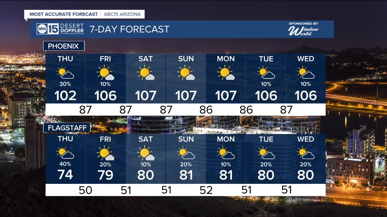
Storm chances will continue into Thursday morning before drier air starts to move in.
A few isolated storms are possible on Friday, but then we'll dry out completely in the Valley over the weekend.


2025 Sky Harbor Official Rainfall to date: 1.63" (-1.67" from average)
Monsoon 2025 Sky Harbor Official Rainfall: 0.16" (-0.22" from average)
_________________________________________
2024 Sky Harbor Official Rainfall to date: 4.54" (-2.68" from average)
Monsoon 2024 Sky Harbor Official Rainfall: 0.74" (-1.69" from average)
__________________________________________
Daily rainfall reports from all across the Valley can be found here.
__________________________________________
PHOENIX IS GETTING DRIER - LOWER RAINFALL AVERAGES NOW
Average Monsoon Rainfall in Phoenix (1981-2010): 2.71" of rain
NEW Average Monsoon Rainfall in Phoenix (1991-2020): 2.43" of rain
Average Yearly Rainfall in Phoenix (1981-2010): 8:03" of rain
NEW Average Yearly Rainfall in Phoenix (1991-2020): 7.22" of rain
__________________________________________
Share your weather photos and videos with us anytime: share@abc15.com.
______________________________________
