

PHOENIX — Extreme Heat and chances for Monsoon Storms return this week.
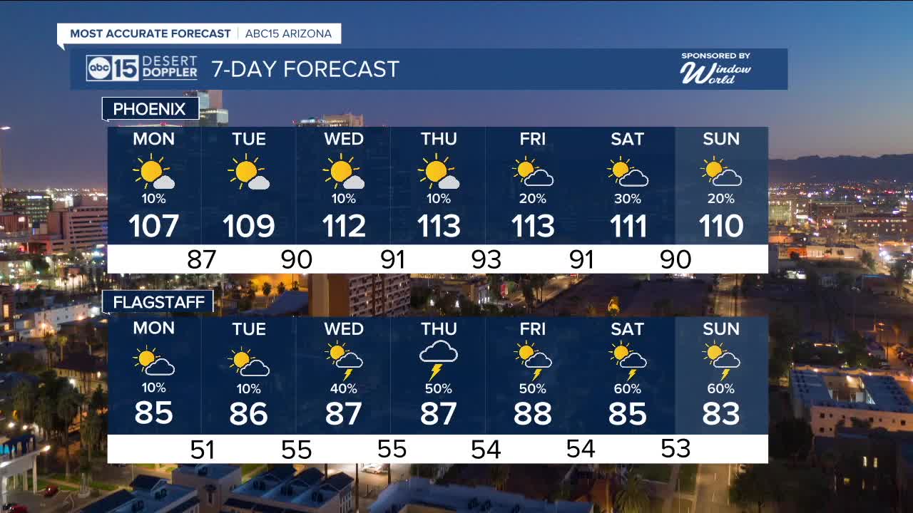
For Monday, there is a chance of light scattered showers in the valley between 4 a.m. to 8 a.m. after that mostly sunny and dry throughout the afternoon. High of 107 is expected in Phoenix.
A ridge of high pressure will move into the desert southwest this week, increasing our afternoon temperatures well above normal and into record territory by midweek.
An Extreme Heat Watch has been issued for central and southern Arizona Wednesday, Thursday and Friday as temperatures are expected to range between 106 to 116 degrees across our lower deserts.
This means Wednesday, Thursday and Friday will be ABC 15 Weather Action Days as the extreme heat can be life threatening.
Plan now for the heat by drinking plenty of water and electrolytes, limiting your outdoor activities between 10 a.m. and 6 p.m., bring the pets inside and remember hiking trails will be closed.
Widespread Major to Extreme heat risks this week meaning everyone is at risk of heat related illnesses. Know the signs of heat exhaustion and heat stroke.
Monsoon storms will mainly be in eastern and northern Arizona for the start of the week.
The Valley begins to see a chance for afternoon and evening storms Wednesday, with our best chance Friday and Saturday.
Stay tuned for updates as the week develops.


_________________________________________
2025 Sky Harbor Official Rainfall to date: 1.63" (-2.71" from average)
Monsoon 2025 Sky Harbor Official Rainfall: 0.16" (-1.20" from average)
__________________________________________
Daily rainfall reports from all across the Valley can be found here.
__________________________________________
PHOENIX IS GETTING DRIER - LOWER RAINFALL AVERAGES NOW
Average Monsoon Rainfall in Phoenix (1981-2010): 2.71" of rain
NEW Average Monsoon Rainfall in Phoenix (1991-2020): 2.43" of rain
Average Yearly Rainfall in Phoenix (1981-2010): 8:03" of rain
NEW Average Yearly Rainfall in Phoenix (1991-2020): 7.22" of rain
__________________________________________
Share your weather photos and videos with us anytime: share@abc15.com.
______________________________________
