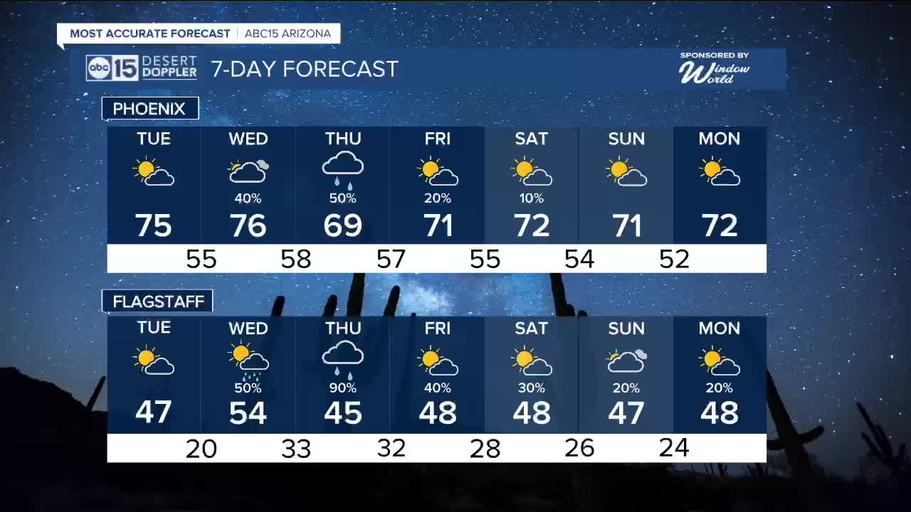


PHOENIX — Heading into Tuesday expect mild but again breezy conditions with a bit more cloud cover. Temperature wise highs in the mid-70s and morning lows in the mid-50s across the Valley.
Expect winds at 10 to 15 miles per hour, gusting as high as 25 in the Valley
Moving into the New Year, all eyes are on a storm brewing in off the coast of southern California. this system will track across SoCal and into Arizona by mid-week bringing a surge of moisture our way.
Rain chances pick up as we head into New Year’s Eve and New Year’s Day, with some areas of Arizona possibly seeing rain linger a bit longer.
There is still some uncertainty with the exact timing and how long the rain sticks around and how much measurable rain we will actually get.
Right now, this looks like mainly a rain event, even in the high country, with snow levels staying high above 9,000 feet with one to three inches of snow.
We will keep tracking it closely and continue to update you as we get closer.


2025 Sky Harbor Official Rainfall to date: 8.31" (+1.14" from average)
Monsoon 2025 Sky Harbor Official Rainfall: 2.76" (+0.33" from average)
__________________________________________
Daily rainfall reports from all across the Valley can be found here.
__________________________________________
PHOENIX IS GETTING DRIER - LOWER RAINFALL AVERAGES NOW
Average Monsoon Rainfall in Phoenix (1981-2010): 2.71" of rain
NEW Average Monsoon Rainfall in Phoenix (1991-2020): 2.43" of rain
Average Yearly Rainfall in Phoenix (1981-2010): 8:03" of rain
NEW Average Yearly Rainfall in Phoenix (1991-2020): 7.22" of rain
__________________________________________
Share your weather photos and videos with us anytime: share@abc15.com.
______________________________________
