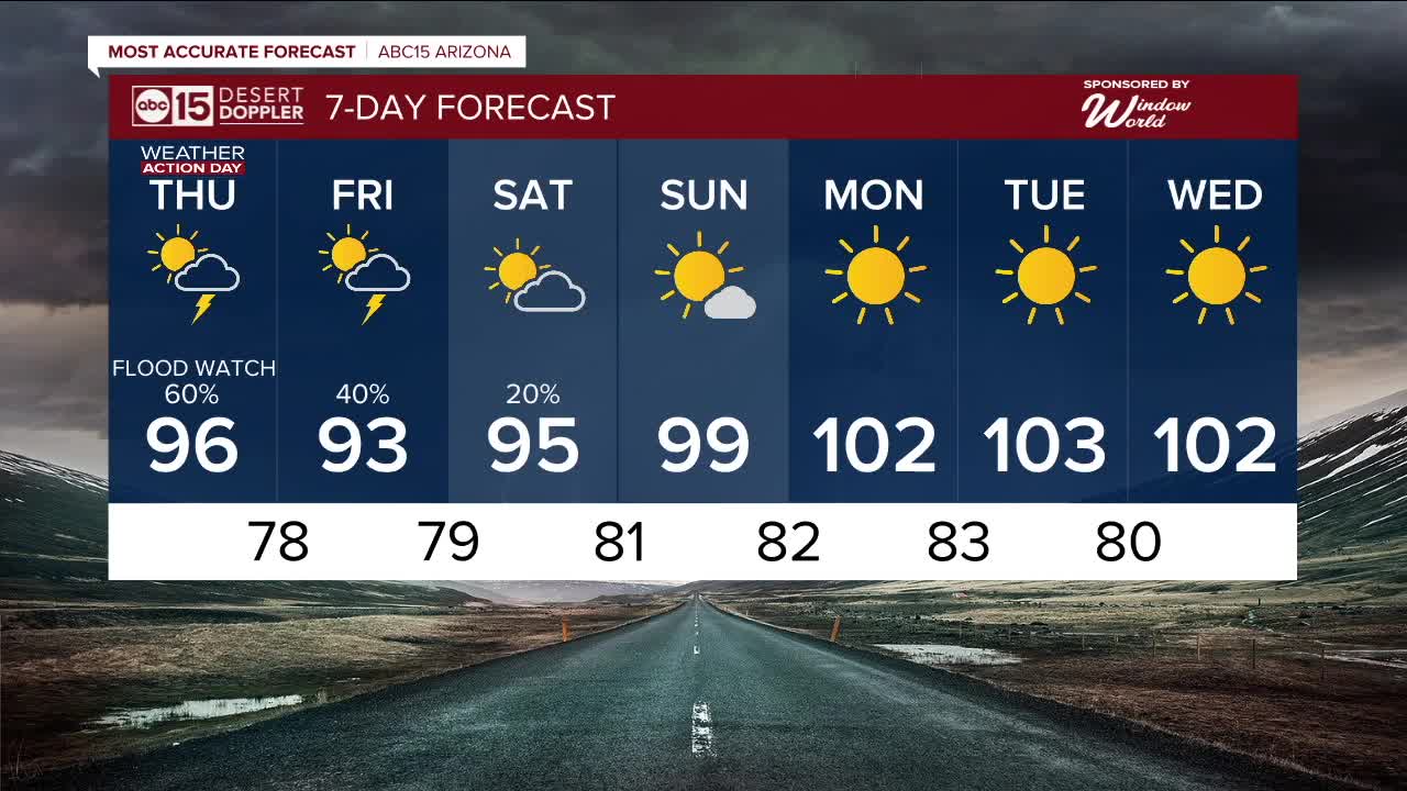


Thursday is an ABC15 Weather Action Day as the threat of monsoon storms and flooding increases across Arizona.
Remnant moisture from now Tropical Storm Lorena are getting caught up in our monsoon flow and significantly increasing storm chances Thursday and Friday.

We could see blowing dust, strong wind gusts, dangerous cloud-to-ground lightning, and pockets of heavy rain that may cause flooding.
A Flood Watch will be in effect from Friday afternoon until Saturday afternoon across southeastern Arizona. Rainfall amounts of 1 to 2 inches, with up to 4 inches in the mountains, are possible across this part of our state.

With this increased moisture and cloud coverage, temperatures are dropping too.
In Phoenix, daytime highs are falling into the mid-90s through Saturday, putting us nearly 10 degrees below normal for early September.

