

PHOENIX — Multiple winter storms are bringing rain, snow and cooler air to Arizona this week.
Wednesday's storm brought wind gusts of 60 to 80 mph to northern Arizona and several inches of snow.
Here in the Valley, we picked up a few hundredths of an inch of rain as gusts topped 30 mph.
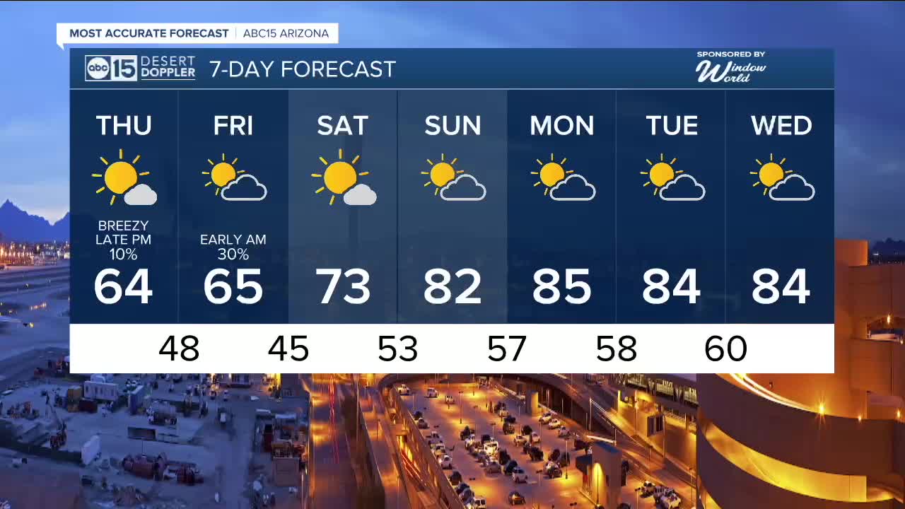
Another winter storm system will impact Arizona late Thursday into early Friday, bringing more rain, snow and wind.
Winter Weather Advisories are in effect from 11 a.m. until 11 p.m. on Thursday across Mohave County. Roads will likely become slick and hazardous. Travel could be very difficult along I-40 between Kingman and Seligman.
Winter Storm Watches are in effect from 5 p.m. Thursday until 11 a.m Friday for areas above 6,500 feet in elevation across the high country. This includes Flagstaff, the Kaibab Plateau and the Mogollon Rim, where an additional four to eight inches of snow could fall.
Here in the Valley, we could see up to a tenth of an inch of rain in some locations in the overnight hours leading into Friday morning. The rest of the day Friday looks dry at this point.
With high pressure building back in this weekend, we're tracking another big warm-up. Expect highs back in the 80s here in the Valley starting Sunday.


2026 Sky Harbor Official Rainfall to date: 0.26" (-1.11" from average)
_________________________________________
2025 Sky Harbor Official Rainfall: 8.31" (+1.09" from average)
Monsoon 2025 Sky Harbor Official Rainfall: 2.76" (+0.33" from average)
__________________________________________
Daily rainfall reports from all across the Valley can be found here.
__________________________________________
PHOENIX IS GETTING DRIER - LOWER RAINFALL AVERAGES NOW
Average Monsoon Rainfall in Phoenix (1981-2010): 2.71" of rain
NEW Average Monsoon Rainfall in Phoenix (1991-2020): 2.43" of rain
Average Yearly Rainfall in Phoenix (1981-2010): 8:03" of rain
NEW Average Yearly Rainfall in Phoenix (1991-2020): 7.22" of rain
__________________________________________
Share your weather photos and videos with us anytime: share@abc15.com.
______________________________________
